earthwork software
Earthwork Software Built for the Field, Not the Office
Updated July 2026
Earthwork software falls into two camps: office tools for takeoff and estimating (AGTEK, Trimble Business Center, Civil 3D) and field tools that document what crews actually build. Gradelog is the field side — it logs grade shots against design elevations with instant pass/fail, records compaction tests with Proctor references, tracks daily production against bid quantities, and turns all of it into inspector-ready as-built PDFs the same day.
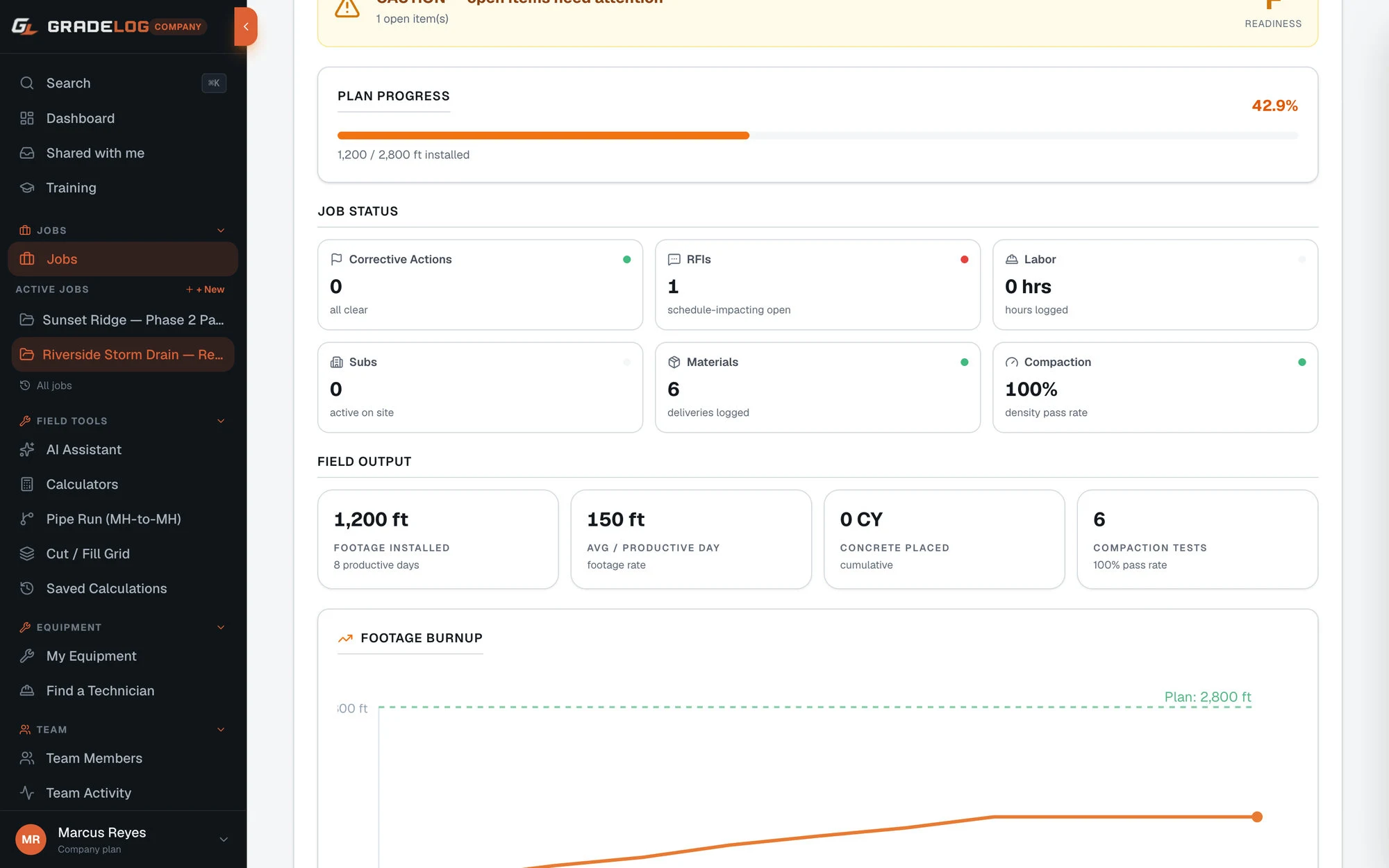
Most software sold as "earthwork software" is estimating and takeoff — cut/fill volumes, mass haul, GPS models. Those tools stop mattering the day the job starts. What the field needs is different: proof the pad hit grade, a defensible compaction record, daily production numbers against the bid, and documentation an inspector will sign.
Gradelog covers that field layer end to end. Every grade shot is compared against design and flagged pass/fail on the spot. Compaction tests log against the Proctor. Trucking and import/export tally from scanned material tickets. And when the phase closes, the as-built PDF generates itself from data that was captured once, in the field, with GPS and timestamps.
Who this is for
- Mass grading and site development contractors
- Excavation companies running their own grade checkers
- Heavy civil subs tracking production against bid quantities
- Superintendents who need daily field records without office re-entry
Takeoff software plans the dirt. Gradelog proves you moved it.
Estimating tools answer "how much dirt is there?" Gradelog answers the questions that come after: is the subgrade at design elevation, did lift 3 pass compaction, how many loads left the site today, and can we prove all of it if quantities are disputed at pay-app time. The two categories work together — many crews build the model in the office and verify against it in the field with Gradelog.
Because everything is logged once at the point of work — with GPS, timestamp, and the instrument that took the shot — there is no nightly retyping and no field-book-to-spreadsheet transcription errors. The office sees production in real time instead of a week later.
Works with the instruments your crews already run
Gradelog imports CSV shot data from Topcon MAGNET Field, Trimble Access, Leica Captivate, and Spectra Precision instruments, and works alongside any rotating laser, pipe laser, GPS rover, or total station. Equipment records track serial numbers and calibration due dates across the whole fleet, so an out-of-cal instrument never undermines a report.
From field data to signed-off documentation
Seven report types generate directly from field data — grade verification, sewer/utility as-builts, pad certification, compaction test reports, daily field reports, plus FAA airport grade and UFC government QC formats on Enterprise. Reports share as public links, so the inspector or engineer opens them without an account and can approve from their phone.
What's included
Grade shots vs design elevation with instant pass/fail
Compaction test logs with Proctor reference
Daily production tracking against bid quantities
Material ticket scanning with OCR — CY and tons auto-tallied
Voice-to-daily-report from the truck
Inspector-ready as-built PDFs in one click
CSV import from Topcon, Trimble, Leica, Spectra
Offline-first — works without signal, syncs later
See it with real project data
Open the live demo — a fully seeded project you can explore without creating an account.
Frequently asked questions
Is Gradelog takeoff or estimating software?
No. Gradelog is field operations software — it documents and verifies the work as it happens. Takeoff tools like AGTEK or Trimble Business Center calculate quantities from plans before the job; Gradelog proves what was built during and after. Crews commonly use both.
Does earthwork software like this require GPS machine control?
No. Gradelog works with whatever your crew runs — a rotating laser and grade rod, a pipe laser, a GPS rover, or a total station. Shots can be entered manually in seconds or imported as CSV from the data collector.
Can it track import/export and trucking quantities?
Yes. Material tickets are photographed and OCR-scanned, with cubic yards and tons tallied automatically per job and per day — a defensible record when hauling quantities are disputed.
What does it cost for a small dirt crew?
There is a free plan, and paid plans start at $29/month for a single field user. Company plans cover whole crews with role-based permissions. All 83 field calculators are free with no account at all.
Does it work offline in a pit or remote site?
Yes. Gradelog is offline-first: log shots, reports, and tickets with no signal, and everything syncs when coverage returns.
Go deeper
From our sister store
Need the hardware too?
Express Tools carries the grade lasers, receivers, and total stations your crews run — Topcon, Trimble, Leica, and Spectra — with expert support from people who use them.
Log it. Prove it. Build with confidence.
Free plan available. Works offline. Cancel anytime — your data is never deleted.