grade checking software
Grade Checking Software That Proves Every Shot
Updated July 2026
Grade checking software replaces the field book: every elevation shot is logged against design grade with instant pass/fail, GPS location, timestamp, and the instrument that took it. Gradelog does this for laser, GPS rover, and total station workflows, imports CSV from Topcon, Trimble, Leica, and Spectra data collectors, and generates the grade verification report that shows the inspector every shot was in tolerance.
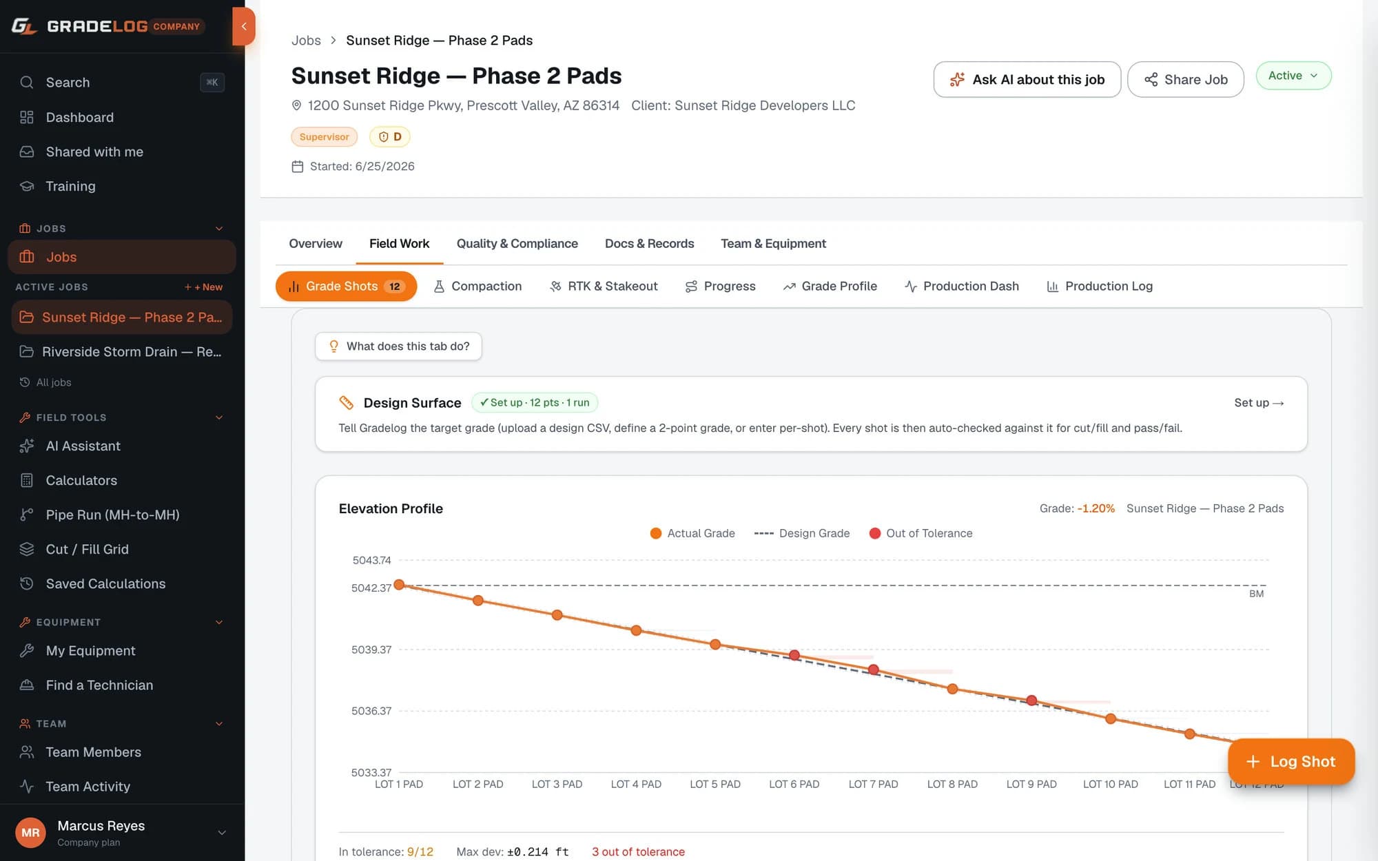
The grade checker's notes are some of the most consequential paperwork on a dirt job — they decide whether subgrade gets signed off, whether the pad certifies, and who pays when something is out of tolerance. And on most crews they still live in a soggy field book that gets retyped at night.
Gradelog turns each check into a structured record: station, design elevation, shot elevation, deviation, pass/fail against your tolerance — plus GPS and timestamp captured automatically. Blue tops, hubs, subgrade, finish grade: every shot lands in one defensible log the office and the engineer can see the moment it syncs.
Who this is for
- Grade checkers and grade setters on grading crews
- Pipe crews checking invert elevations against cut sheets
- Foremen who sign off subgrade before paving or concrete
- Survey crews handing verification data to contractors
Pass/fail at the moment of the shot — not next week
Enter the design elevation and tolerance once. Every shot after that shows an immediate pass or fail, so an out-of-tolerance area gets re-worked while the machine is still on it — not discovered in the office three days later when the crew has moved across the site.
Failed shots can be flagged, re-shot, and resolved in place, leaving a clean audit trail of what was found and what was fixed.
Every instrument workflow, one log
Laser and grade rod crews type shots in seconds. GPS rover and total station crews import CSV straight from MAGNET Field, Trimble Access, Leica Captivate, or Spectra collectors. Either way the record is identical: located, timestamped, compared against design, and tied to the instrument and its calibration record.
The report the inspector actually accepts
One click turns the shot log into a grade verification report — every point, its deviation, and the pass/fail summary — as a branded PDF or a share link the inspector opens with no account. For pads there is a dedicated pad certification format; for pipe, sewer and utility as-builts with invert elevations manhole to manhole.
What's included
Instant pass/fail against design grade and tolerance
GPS-located, timestamped shots tied to stations
Flag, re-shoot and resolve out-of-tolerance points
CSV import from Topcon, Trimble, Leica, Spectra
Grade verification and pad certification reports
Inspector share links — no login required
Equipment calibration tracking per instrument
Works offline, syncs when signal returns
See it with real project data
Open the live demo — a fully seeded project you can explore without creating an account.
Frequently asked questions
What is grade checking software?
Software that records elevation shots against design grade and computes the deviation on the spot. Instead of a hand-written field book, each check becomes a structured, GPS-tagged record with pass/fail status that rolls straight into a grade verification report.
Do I need a GPS rover, or does it work with a laser and rod?
It works with both. Laser-and-rod crews enter shots manually in a couple of taps; rover and total station crews import CSV from the data collector. The design comparison and reporting are the same either way.
Can inspectors see the shots without an account?
Yes. Reports share as public links — the inspector opens the grade verification on their phone, reviews every shot, and can approve or reject without creating an account.
How does it handle blue tops and hub checks?
Each check is logged against its station and design elevation, so blue-top verification across a large site becomes a running list of passed points — and re-staking after weather is documented rather than argued about.
Is there a free way to try it?
Yes — a free plan, a live demo with real project data you can open without signing up, and 83 free field calculators including grade percentage and slope tools.
Go deeper
From our sister store
Need the hardware too?
Express Tools carries the grade lasers, receivers, and total stations your crews run — Topcon, Trimble, Leica, and Spectra — with expert support from people who use them.
Log it. Prove it. Build with confidence.
Free plan available. Works offline. Cancel anytime — your data is never deleted.